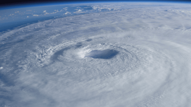
Tropical Storm Hernan Forms in Pacific as Hawaii Braces for Potential Heavy Rain and Flooding
Sienna Ruiz|August 13, 2026
Tropical Storm Hernan formed in the eastern Pacific Ocean on Thursday, August 13, as forecasters continued monitoring a separate tropical system that could bring heavy rain, strong winds and dangerous surf to Hawaii later this week. While Hernan was not posing an immediate threat to land, the developing weather pattern has placed increased attention on conditions across the Pacific and the potential impacts for Hawaii.
According to the National Hurricane Center, Tropical Storm Hernan developed from a tropical depression over the Pacific. As of Thursday, the storm was located roughly 1,460 miles west of the southern tip of Mexico’s Baja California peninsula. It had maximum sustained winds of about 40 mph and was moving westward over open water.
Forecasters said Hernan was not threatening land at the time it formed. Its location and westward movement meant that the storm was expected to remain over the Pacific rather than immediately affecting the United States or Mexico.
The more immediate concern for the United States was a separate disturbance identified as Potential Tropical Cyclone One-C, located east-southeast of Hawaii.
Hawaii Monitors a Separate Tropical System
While Tropical Storm Hernan remained far from land, Potential Tropical Cyclone One-C was being closely watched because of its possible effects on Hawaii.
The system was approximately 775 miles east-southeast of the Hawaiian Islands on Thursday. Forecasters said it was not yet organized enough to be classified as a tropical storm, but conditions could become more significant as the system moved closer to the islands.
The National Hurricane Center warned that the system could bring heavy rainfall, strong winds and dangerous surf beginning late Friday. Forecast guidance indicated that parts of Hawaii could receive between 5 and 10 inches of rain, with isolated totals potentially reaching 20 inches.
Such rainfall can create significant risks in Hawaii because intense precipitation over a short period can lead to flash flooding, landslides and dangerous road conditions. Coastal areas may also experience rough surf and hazardous conditions as the system approaches.
Forecasters were also watching the possibility that the system could reach the southern portion of Hawaii’s Big Island as a tropical storm on Saturday. The exact strength and track could still change as additional weather data became available.
Why the Developments Matter
The formation of Hernan is part of the broader tropical weather activity that occurs across the Pacific during hurricane season. Tropical systems can develop quickly when ocean temperatures, atmospheric moisture and wind conditions become favorable.
For Hawaii, the developing system east of the islands is more immediately important than Hernan because of its potential to affect populated areas.
Heavy rain is often one of the most significant hazards associated with tropical systems approaching Hawaii. Even when a storm does not make a direct landfall, its moisture can produce intense rainfall across the islands. Mountainous terrain can further increase the risk of rapid runoff and localized flooding.
The situation also highlights why residents and visitors should pay attention to official weather information rather than relying solely on a storm’s classification. A system does not need to become a major hurricane to create dangerous conditions.
What Residents and Visitors Should Watch
People in Hawaii should continue monitoring forecasts as the system approaches. Weather conditions can change, and forecasters may adjust projected rainfall amounts, wind speeds and the expected track as new observations become available.
Residents in areas vulnerable to flooding should be especially attentive to local advisories. Travelers should also be prepared for potential disruptions involving roads, outdoor activities and coastal conditions if the weather deteriorates.
At the same time, there is no indication that Tropical Storm Hernan itself presents an immediate threat to Hawaii or the U.S. mainland. Its current position far to the west of Baja California and its westward movement keep it separate from the more immediate weather concern near Hawaii.
A Developing Pacific Weather Situation
Thursday’s developments demonstrate how quickly tropical weather conditions can evolve during hurricane season. One system has already strengthened into a named tropical storm, while another is being monitored for possible impacts on a U.S. state.
For now, the most important distinction is between the two systems. Hernan is a named storm over open Pacific waters with no immediate land threat, while Potential Tropical Cyclone One-C could affect Hawaii with heavy rainfall, strong winds and dangerous surf beginning later this week.
Forecasters will continue tracking both systems and updating their projections as conditions change. For Hawaii, the coming days will be particularly important as officials and residents assess the potential for flooding and other weather-related hazards.

LA Highlight Contributor
Covers the local desk, reporting on the neighbourhoods, civic life, and daily news of Los Angeles.
This article features partner, contributor, or branded content from a third party. Members of the LA Highlight editorial staff were not involved in the creation of this content. All views and opinions are those of the contributor alone.